 pyMaxima
CAS in Python über Maxima & PyGeo
-
pyMaxima ist eine einfache GUI-Schnittstelle zu Maxima, geschrieben in Python
-
"Maxima is a system for the manipulation of symbolic and numerical expressions, including differentiation, integration, Taylor series, Laplace transforms, ordinary differential equations, systems of linear equations, polynomials, and sets, lists, vectors, matrices, and tensors." (Quelle: http://maxima.sourceforge.net/)
Das Maxima Computer Algebra System wurde durch William Schelter initiiert.
- Ein Programm mit ähnlicher Zielrichtung ist wxMaxima: wxMaxima "is a cross platform GUI for the computer algebra system maxima based on wxWidgets." (Quelle: http://wxmaxima.sourceforge.net/)
- "PyGeo is a framework for the creation of dynamic geometric constructions" (Quelle: http://pygeo.sourceforge.net/).
PyGeo wurde entwickelt von Arthur Siegel.
Über . . .
Download
- pyMaxima.zip (Windows: gepackt, Version 1.70, 2012-11-17, 340 KB)
- pyMaxima.tar.gz (Linux: tared & gzipped, Version 1.70, 2012-11-17, 320 KB)
pyMaxima wurde getestet unter Linux, Windows XP und Windows 7, sollte aber überall dort laufen, wo Maxima und Python (incl. VPython & PyGeo) funktionieren.
PyGeo
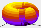
pyMaxima benutzt pyGeo für die 3D-Darstellung geometrischer Objekte wie Geraden, Ebenen oder Kugeln: pyGeo-Beispiel.
Beachte: pyGeo benötigt zusätzlich:
-
VPython
-
Numerical Python
(Numerical Python wird zusammen mit VPython installiert)
-
Beachte: pygeo lässt sich nur bis zu Python 2.7 installieren!
Folgendes Paket muss installliert werden, falls man unter Python 2.5 bis Python 2.7 arbeitet:
Vielen Dank an einen Blogger für das Update von PyGeo!
pyMaxima wird ohne pyGeo arbeiten, aber du kannst nicht die
Bilder sehen!
Installation
- Zuerst: du benötigst Maxima,
pyMaxima arbeitet mit den Maxima-Versionen 5.10.0 bis 5.28
Beachte: ohne Maxima wird pyMaxima nicht funktionieren!
- Python (Vers. 2.4 bis 2.7) inklusive Tkinter.
- Auf win32-Systemen (Win 2000, Win XP, Win Vista) benötigt pyMaxima die Python for Windows Extensions
- Die 3D-pyGeo Darstellungen erfordern VPython und pyGeo (Numerical Python wird zusammen mit VPython installiert)
Beachte: pygeo lässt sich nur bis zu Python 2.7 installieren!
Folgendes Paket muss installliert werden, falls man unter Python 2.5 bis Python 2.7 arbeitet:
- Entpacke
pyMaxima.zip (Windows) oder pyMaxima.tar.gz (Linux) in ein Unterverzeichnis
- Unter Linux: Überprüfe die Einträge in der Konfigurations-Datei
linuxInit.conf. Beachte, dass die Datei interface.lisp im gleichen Verzeichnis wie pyMaxima.py ist.
Starte eine Shell und gebe ein: python pyMaxima.py
- Auf win32-Systemen: Überprüfe die Einträge in der Konfigurations-Datei winInit.conf. Beachte, dass die Datei
interface.lisp im gleichen Verzeichnis wie pyMaxima.py ist.
Doppelklick auf pyMaxima.py und -wichtig!- schließe nicht das schwarze Fenster im Hintergrund!
Maxima-Dokumentation
Beachte
"Be warned that these systems are no substitute for hands on work with equations and struggling with concepts.
These systems do not build your mathematical intuition, nor will they strengthen your core skills."
Und: "Do not use a computer as a substitute for your basic education."
Aus dem The Maxima Book, S. 7
Credits
Vielen Dank an